I'm not sure there'll be a lot to write about this trip. It's not that it wasn't interesting, but it was fairly straight forward with not a lot of twists and turns. What it gets down to is that, as a resident of Los Angeles, I've been looking to use local transit systems to extend my cycling and hiking without having to drive.
So, I got up a lot earlier than normal, got on my bike and rode the half mile trip to the Glendale Metrolink Station, bought a ticket and got on the first train to Lancaster, in the Antelope Valley, in the high desert. I had been following weather forecasts, and realized I had a brief window for cycling when it would be warm rather than blistering hot, and breezy, rather than windy enough to blow things over.
Metrolink has a car with spaces for bikes, (And surfboards.) Because I was the only cyclist, and because I was going to the end of the line, I was able to tie up the bike without having to worry about blocking someone in. Nice, since It allowed me to sit on the upper level, where the views are better. Normally I wouldn't care all that much, but it is a two hour trip, and it's best to have something nice to look at.
It was a quarter to nine when we arrived at the station, about fifteen minutes after the posted arrival time. Over the years I've taken Metrolink a number of times, and on time, give or take fifteen is about average. I got off the train, got on the bike and headed north on Sierra Highway, headed for Mojave, small town, rail yard, and truck stop. Also the home of an airplane junkyard, and an airport where work is being done on private spacecraft, a weird mix of the down, the out, the past, and the future.
My plan was to take one of the side roads off of the Highway. While I've never really explored much of the area in any fashion, I did know that this section of the Antelope Valley has roads laid out in a grid. The blocks are pretty big, but I figured, right angles, what could go wrong? I passed a couple of roads before I decided on Avenue E. As I rode east, I noticed that the northern side of the road followed a fence with signs every few yards. I got curious, so I cut across the road. The signs were a warning about trespassing, posted by the U.S. Air Force. I was riding right next to Edwards Air Force Base. I had gone a bit too far to bypass Sierra Highway by going east then north, so at 30th Street East, I made a right turn, and headed back in the general direction of Lancaster. I hadn't given up on the idea of riding to Mojave, but I did want to explore some of the desert not adjacent to the well traveled Sierra Highway.
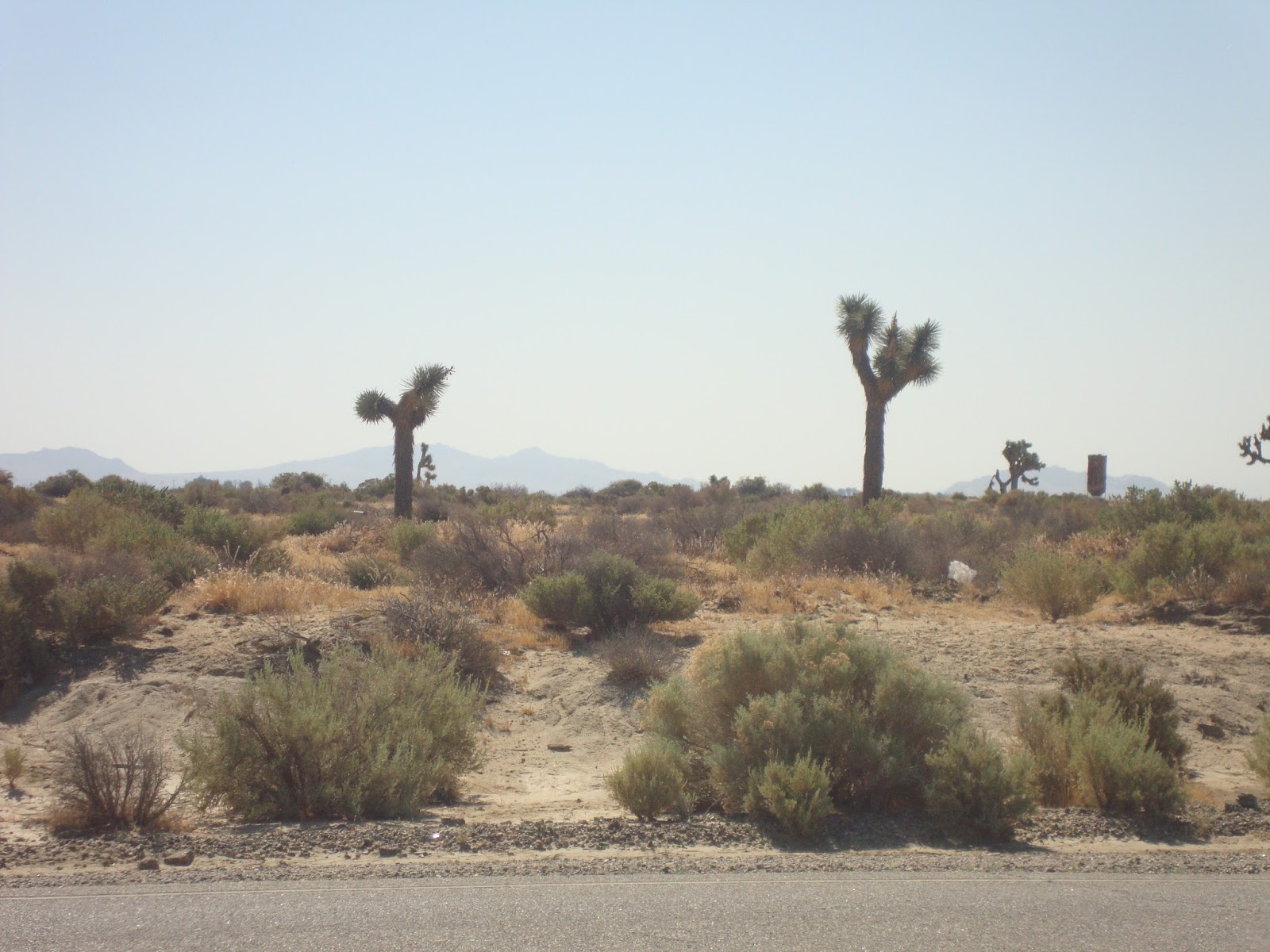
Many people think of the high desert as being desolate, and it's true that the landscape can be pretty monotonous. But, I like deserts. There are a lot of things, both man made and natural, to see. Before I came west, I had never seen the roadside shrines to accident victims, and I passed more than a few on my ride. I can only image, it's late at night, long straight roads, with no street lights; moonless, perhaps too much speed, or one drink too many. A sudden veer to the right, the sandy shoulder, and the car rolls. Benny Serrano's memorial showed him to be a Raiders fan. His was the one I stopped to really examine, but there were others. Too, I passed a long section of road with a lot of debris. Furniture, clothes, and lots of toys. None of it was broken up, and hadn't faded from the sun. My guess was that someone was moving,perhaps that morning, and the tarp came off the back of the pickup truck.
At Avenue G, I headed east. I figured I'd go for awhile, turn north back to Avenue E, and then head back to Sierra Highway. One of the things about the high desert is that even when the weather forecast is breezy, well, that doesn't have the same meaning as it does in L.A. Too, the winds have a tendency to swirl around up there, so it's possible to have a head wind while going one direction, then a few minutes after having turned to another compass point to hit another head wind. And that's what happened to me. It seemed like I spent the whole day fighting the wind.
As I rode down Avenue G, I passed, open desert, Joshua Trees, abandoned buildings, and even a working farm. (Alfalfa, I think.) Normally, I would have poked around the old buildings, and wandered down some of the dirt tracks, but that would have meant a loss of momentum, so I limited my stops to take a few pictures,and then moved on. Too, I didn't know how long it would take me to get to Mojave, and then back to Lancaster. If I missed the last train, I'd be stuck there for the night.
Anyway, I gave up on Avenue G, and turned north on 70th Street East, returned to Avenue E and the long ride back to Sierra Highway. There were a few houses along the north side of the road, but it didn't take long before I was once again paralleling Edwards Air Force Base.
Back at the Highway, I turned north to Mojave. It wasn't that far until I got to the town of Rosamond, a depressing collection of run down building, industrial parks, and, if I counted correctly, seven marijuana dispensaries. And that was just along the main road. There were a few blocks on either side of Sierra Highway, but, even though it wasn't yet noon, I was still thinking about time. If nothing else, there were gas station convenience stores, and a small market, I was getting tired of drinking warm water from the hydration pack, so I stopped off for something sweet, cold, and fizzy to drink.
I had been on a long, slight climb ever since leaving Lancaster, but beyond Rosamond, the angle kicked up a notch. It wasn't that steep, but the wind was also a lot stronger, so I had to change gears and stand up on the peddles. After cresting, things leveled out a bit, or at least became less steep. I was more or less paralleling Route 14, the four lane highway that went to Mojave and beyond, and I could see a gap between a couple of hills, so I figured, if nothing else the wind would be less after that. I was right about that, but then I came to the end of Sierra Highway. At least the paved part, there was a dirt road beyond a gravel pile that was headed in the right direction.
It was pretty clear that the 14 had replaced that part of the road. I had driven the 14 plenty of times, so I was sure I was close to Mojave, so I took my road bike with it's skinny tires off pavement and on to dirt. It didn't take long until I dismounted and began pushing the bike. There were parts I could have ridden, but after a few yards, the route would become sandy and I'd lose traction, or covered in rocks, and impassable. Rather than riding a bit and pushing a bit I just pushed. Eventually, the dirt track passed over Purdy Road. I was tempted to get on the 14. It was still four lanes, but Purdy Road crossed all four lanes of the highway. It seemed to me that with cross traffic, the 14 was no longer a limited access highway and it would be legal to ride. But, I had to face a harsh reality. I could take off for the desert on a weekday because I only work part time. I can pay my rent and other bills on what I earn, but not if I get a $200 fine for riding where I'm not allowed. I was hoping I'd run into a cop in Mojave and get a clarification. Why is it that I only see the police when it's inconvenient, and never when I need some help?
So, I kept pushing, and ended up at the edge of the Mojave Rail Yard. I was certainly not allowed on the tracks. There were plenty of signs warning me of all the laws I was violating, so I put the bike on my shoulder, sprinted across the tracks and was finally in downtown Mojave. I was hungry, it was lunch time so I settled for some fast food, got on the bike and started the return trip to Lancaster.
As I was going back towards the dirt track, I saw the a trailer park and the Full Gospel House of Prayer on my left. I could see that a dirt road headed south from the side of the church so I took my life in my hands, crossed traffic in front of a truck, and went exploring. It didn't take long for the road to become a tire track across the desert, but the dirt was compacted, so I kept riding. As it began to curl towards some chemical tanks and a small industrial site, I dismounted and carried the bike back to the dirt track north of Purdy Road, When I hit that route, I decided to take it. It was paved, so it seemed like a good idea to see where it went. Not far actually, but where it ended, United Road began. From there I hit Reed Road. There were houses, and trailers, and when I saw a school bus unloading kids, I began to think I would get back to Sierra Highway. And I did, but not before turning onto Lone Butte, then Sopp Road, and then the Highway, just a few miles north of Rosamond.
I could have stayed on Sierra Highway and been in Lancaster with plenty of time to catch my train. On the 14, the two towns are less than thirty miles apart, so as I had worried about time on the way north, I was confident about time on the way south. I turned off the highway on Avenue E. On my earlier explorations, I had passed Division Road, it looked like it headed to Lancaster, and if nothing else there wouldn't be as much traffic. As far as traffic went, it was a good decision but the road was so torn up, that I had to slow down and navigate around all the potholes. As time went by, I began to pass houses, scrap yards, and eventually, I passed into Lancaster proper. At Avenue I, I saw a designated bike lane, the pavement wasn't turning back into a gravel road, so I headed back to Sierra Highway and the railroad station.
But, I had a two hour wait for the 6:30 train. On my ride up, I had noticed an actual bike path along the rail tracks that seemed to connect Lancaster with the Palmdale Metrolink Station, so I ended up riding even further. When I finally got to Palmdale, I still had a good hour to kill, so I rode around the local streets, and, except for an antique mall that I would have enjoyed visiting, which was closed, I didn't find anything really interesting. So, it was back to the station, the two hour train ride home, and a notion that my next ride would be better off in late April or early May, rather than the first week of June.
I do keep a computer on the bike. Total miles, including the ride from my apartment to the Glendale Station and my circling the block in Palmdale, 87.85 miles.


 The last picture in this group was taken just off of Basin Road, at the north end of Cave Mountain on the day after the other pictures.