Thursday, June 15, 2017
From Lancaster to Mojave, California
I'm not sure there'll be a lot to write about this trip. It's not that it wasn't interesting, but it was fairly straight forward with not a lot of twists and turns. What it gets down to is that, as a resident of Los Angeles, I've been looking to use local transit systems to extend my cycling and hiking without having to drive.
So, I got up a lot earlier than normal, got on my bike and rode the half mile trip to the Glendale Metrolink Station, bought a ticket and got on the first train to Lancaster, in the Antelope Valley, in the high desert. I had been following weather forecasts, and realized I had a brief window for cycling when it would be warm rather than blistering hot, and breezy, rather than windy enough to blow things over.
Metrolink has a car with spaces for bikes, (And surfboards.) Because I was the only cyclist, and because I was going to the end of the line, I was able to tie up the bike without having to worry about blocking someone in. Nice, since It allowed me to sit on the upper level, where the views are better. Normally I wouldn't care all that much, but it is a two hour trip, and it's best to have something nice to look at.
It was a quarter to nine when we arrived at the station, about fifteen minutes after the posted arrival time. Over the years I've taken Metrolink a number of times, and on time, give or take fifteen is about average. I got off the train, got on the bike and headed north on Sierra Highway, headed for Mojave, small town, rail yard, and truck stop. Also the home of an airplane junkyard, and an airport where work is being done on private spacecraft, a weird mix of the down, the out, the past, and the future.
My plan was to take one of the side roads off of the Highway. While I've never really explored much of the area in any fashion, I did know that this section of the Antelope Valley has roads laid out in a grid. The blocks are pretty big, but I figured, right angles, what could go wrong? I passed a couple of roads before I decided on Avenue E. As I rode east, I noticed that the northern side of the road followed a fence with signs every few yards. I got curious, so I cut across the road. The signs were a warning about trespassing, posted by the U.S. Air Force. I was riding right next to Edwards Air Force Base. I had gone a bit too far to bypass Sierra Highway by going east then north, so at 30th Street East, I made a right turn, and headed back in the general direction of Lancaster. I hadn't given up on the idea of riding to Mojave, but I did want to explore some of the desert not adjacent to the well traveled Sierra Highway.
Many people think of the high desert as being desolate, and it's true that the landscape can be pretty monotonous. But, I like deserts. There are a lot of things, both man made and natural, to see. Before I came west, I had never seen the roadside shrines to accident victims, and I passed more than a few on my ride. I can only image, it's late at night, long straight roads, with no street lights; moonless, perhaps too much speed, or one drink too many. A sudden veer to the right, the sandy shoulder, and the car rolls. Benny Serrano's memorial showed him to be a Raiders fan. His was the one I stopped to really examine, but there were others. Too, I passed a long section of road with a lot of debris. Furniture, clothes, and lots of toys. None of it was broken up, and hadn't faded from the sun. My guess was that someone was moving,perhaps that morning, and the tarp came off the back of the pickup truck.
At Avenue G, I headed east. I figured I'd go for awhile, turn north back to Avenue E, and then head back to Sierra Highway. One of the things about the high desert is that even when the weather forecast is breezy, well, that doesn't have the same meaning as it does in L.A. Too, the winds have a tendency to swirl around up there, so it's possible to have a head wind while going one direction, then a few minutes after having turned to another compass point to hit another head wind. And that's what happened to me. It seemed like I spent the whole day fighting the wind.
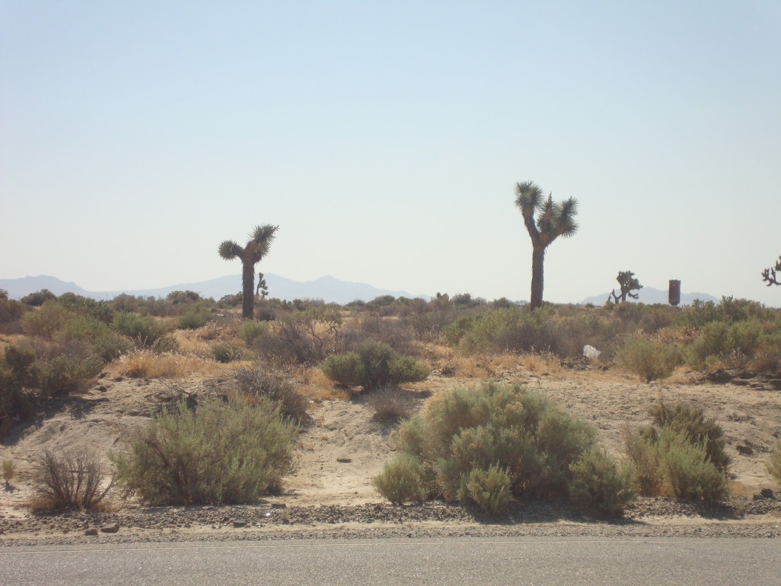
As I rode down Avenue G, I passed, open desert, Joshua Trees, abandoned buildings, and even a working farm. (Alfalfa, I think.) Normally, I would have poked around the old buildings, and wandered down some of the dirt tracks, but that would have meant a loss of momentum, so I limited my stops to take a few pictures,and then moved on. Too, I didn't know how long it would take me to get to Mojave, and then back to Lancaster. If I missed the last train, I'd be stuck there for the night.
Anyway, I gave up on Avenue G, and turned north on 70th Street East, returned to Avenue E and the long ride back to Sierra Highway. There were a few houses along the north side of the road, but it didn't take long before I was once again paralleling Edwards Air Force Base.
Back at the Highway, I turned north to Mojave. It wasn't that far until I got to the town of Rosamond, a depressing collection of run down building, industrial parks, and, if I counted correctly, seven marijuana dispensaries. And that was just along the main road. There were a few blocks on either side of Sierra Highway, but, even though it wasn't yet noon, I was still thinking about time. If nothing else, there were gas station convenience stores, and a small market, I was getting tired of drinking warm water from the hydration pack, so I stopped off for something sweet, cold, and fizzy to drink.
I had been on a long, slight climb ever since leaving Lancaster, but beyond Rosamond, the angle kicked up a notch. It wasn't that steep, but the wind was also a lot stronger, so I had to change gears and stand up on the peddles. After cresting, things leveled out a bit, or at least became less steep. I was more or less paralleling Route 14, the four lane highway that went to Mojave and beyond, and I could see a gap between a couple of hills, so I figured, if nothing else the wind would be less after that. I was right about that, but then I came to the end of Sierra Highway. At least the paved part, there was a dirt road beyond a gravel pile that was headed in the right direction.
It was pretty clear that the 14 had replaced that part of the road. I had driven the 14 plenty of times, so I was sure I was close to Mojave, so I took my road bike with it's skinny tires off pavement and on to dirt. It didn't take long until I dismounted and began pushing the bike. There were parts I could have ridden, but after a few yards, the route would become sandy and I'd lose traction, or covered in rocks, and impassable. Rather than riding a bit and pushing a bit I just pushed. Eventually, the dirt track passed over Purdy Road. I was tempted to get on the 14. It was still four lanes, but Purdy Road crossed all four lanes of the highway. It seemed to me that with cross traffic, the 14 was no longer a limited access highway and it would be legal to ride. But, I had to face a harsh reality. I could take off for the desert on a weekday because I only work part time. I can pay my rent and other bills on what I earn, but not if I get a $200 fine for riding where I'm not allowed. I was hoping I'd run into a cop in Mojave and get a clarification. Why is it that I only see the police when it's inconvenient, and never when I need some help?
So, I kept pushing, and ended up at the edge of the Mojave Rail Yard. I was certainly not allowed on the tracks. There were plenty of signs warning me of all the laws I was violating, so I put the bike on my shoulder, sprinted across the tracks and was finally in downtown Mojave. I was hungry, it was lunch time so I settled for some fast food, got on the bike and started the return trip to Lancaster.
As I was going back towards the dirt track, I saw the a trailer park and the Full Gospel House of Prayer on my left. I could see that a dirt road headed south from the side of the church so I took my life in my hands, crossed traffic in front of a truck, and went exploring. It didn't take long for the road to become a tire track across the desert, but the dirt was compacted, so I kept riding. As it began to curl towards some chemical tanks and a small industrial site, I dismounted and carried the bike back to the dirt track north of Purdy Road, When I hit that route, I decided to take it. It was paved, so it seemed like a good idea to see where it went. Not far actually, but where it ended, United Road began. From there I hit Reed Road. There were houses, and trailers, and when I saw a school bus unloading kids, I began to think I would get back to Sierra Highway. And I did, but not before turning onto Lone Butte, then Sopp Road, and then the Highway, just a few miles north of Rosamond.
I could have stayed on Sierra Highway and been in Lancaster with plenty of time to catch my train. On the 14, the two towns are less than thirty miles apart, so as I had worried about time on the way north, I was confident about time on the way south. I turned off the highway on Avenue E. On my earlier explorations, I had passed Division Road, it looked like it headed to Lancaster, and if nothing else there wouldn't be as much traffic. As far as traffic went, it was a good decision but the road was so torn up, that I had to slow down and navigate around all the potholes. As time went by, I began to pass houses, scrap yards, and eventually, I passed into Lancaster proper. At Avenue I, I saw a designated bike lane, the pavement wasn't turning back into a gravel road, so I headed back to Sierra Highway and the railroad station.
But, I had a two hour wait for the 6:30 train. On my ride up, I had noticed an actual bike path along the rail tracks that seemed to connect Lancaster with the Palmdale Metrolink Station, so I ended up riding even further. When I finally got to Palmdale, I still had a good hour to kill, so I rode around the local streets, and, except for an antique mall that I would have enjoyed visiting, which was closed, I didn't find anything really interesting. So, it was back to the station, the two hour train ride home, and a notion that my next ride would be better off in late April or early May, rather than the first week of June.
I do keep a computer on the bike. Total miles, including the ride from my apartment to the Glendale Station and my circling the block in Palmdale, 87.85 miles.
So, I got up a lot earlier than normal, got on my bike and rode the half mile trip to the Glendale Metrolink Station, bought a ticket and got on the first train to Lancaster, in the Antelope Valley, in the high desert. I had been following weather forecasts, and realized I had a brief window for cycling when it would be warm rather than blistering hot, and breezy, rather than windy enough to blow things over.
Metrolink has a car with spaces for bikes, (And surfboards.) Because I was the only cyclist, and because I was going to the end of the line, I was able to tie up the bike without having to worry about blocking someone in. Nice, since It allowed me to sit on the upper level, where the views are better. Normally I wouldn't care all that much, but it is a two hour trip, and it's best to have something nice to look at.
It was a quarter to nine when we arrived at the station, about fifteen minutes after the posted arrival time. Over the years I've taken Metrolink a number of times, and on time, give or take fifteen is about average. I got off the train, got on the bike and headed north on Sierra Highway, headed for Mojave, small town, rail yard, and truck stop. Also the home of an airplane junkyard, and an airport where work is being done on private spacecraft, a weird mix of the down, the out, the past, and the future.
My plan was to take one of the side roads off of the Highway. While I've never really explored much of the area in any fashion, I did know that this section of the Antelope Valley has roads laid out in a grid. The blocks are pretty big, but I figured, right angles, what could go wrong? I passed a couple of roads before I decided on Avenue E. As I rode east, I noticed that the northern side of the road followed a fence with signs every few yards. I got curious, so I cut across the road. The signs were a warning about trespassing, posted by the U.S. Air Force. I was riding right next to Edwards Air Force Base. I had gone a bit too far to bypass Sierra Highway by going east then north, so at 30th Street East, I made a right turn, and headed back in the general direction of Lancaster. I hadn't given up on the idea of riding to Mojave, but I did want to explore some of the desert not adjacent to the well traveled Sierra Highway.
Many people think of the high desert as being desolate, and it's true that the landscape can be pretty monotonous. But, I like deserts. There are a lot of things, both man made and natural, to see. Before I came west, I had never seen the roadside shrines to accident victims, and I passed more than a few on my ride. I can only image, it's late at night, long straight roads, with no street lights; moonless, perhaps too much speed, or one drink too many. A sudden veer to the right, the sandy shoulder, and the car rolls. Benny Serrano's memorial showed him to be a Raiders fan. His was the one I stopped to really examine, but there were others. Too, I passed a long section of road with a lot of debris. Furniture, clothes, and lots of toys. None of it was broken up, and hadn't faded from the sun. My guess was that someone was moving,perhaps that morning, and the tarp came off the back of the pickup truck.
At Avenue G, I headed east. I figured I'd go for awhile, turn north back to Avenue E, and then head back to Sierra Highway. One of the things about the high desert is that even when the weather forecast is breezy, well, that doesn't have the same meaning as it does in L.A. Too, the winds have a tendency to swirl around up there, so it's possible to have a head wind while going one direction, then a few minutes after having turned to another compass point to hit another head wind. And that's what happened to me. It seemed like I spent the whole day fighting the wind.
As I rode down Avenue G, I passed, open desert, Joshua Trees, abandoned buildings, and even a working farm. (Alfalfa, I think.) Normally, I would have poked around the old buildings, and wandered down some of the dirt tracks, but that would have meant a loss of momentum, so I limited my stops to take a few pictures,and then moved on. Too, I didn't know how long it would take me to get to Mojave, and then back to Lancaster. If I missed the last train, I'd be stuck there for the night.
Anyway, I gave up on Avenue G, and turned north on 70th Street East, returned to Avenue E and the long ride back to Sierra Highway. There were a few houses along the north side of the road, but it didn't take long before I was once again paralleling Edwards Air Force Base.
Back at the Highway, I turned north to Mojave. It wasn't that far until I got to the town of Rosamond, a depressing collection of run down building, industrial parks, and, if I counted correctly, seven marijuana dispensaries. And that was just along the main road. There were a few blocks on either side of Sierra Highway, but, even though it wasn't yet noon, I was still thinking about time. If nothing else, there were gas station convenience stores, and a small market, I was getting tired of drinking warm water from the hydration pack, so I stopped off for something sweet, cold, and fizzy to drink.
I had been on a long, slight climb ever since leaving Lancaster, but beyond Rosamond, the angle kicked up a notch. It wasn't that steep, but the wind was also a lot stronger, so I had to change gears and stand up on the peddles. After cresting, things leveled out a bit, or at least became less steep. I was more or less paralleling Route 14, the four lane highway that went to Mojave and beyond, and I could see a gap between a couple of hills, so I figured, if nothing else the wind would be less after that. I was right about that, but then I came to the end of Sierra Highway. At least the paved part, there was a dirt road beyond a gravel pile that was headed in the right direction.
It was pretty clear that the 14 had replaced that part of the road. I had driven the 14 plenty of times, so I was sure I was close to Mojave, so I took my road bike with it's skinny tires off pavement and on to dirt. It didn't take long until I dismounted and began pushing the bike. There were parts I could have ridden, but after a few yards, the route would become sandy and I'd lose traction, or covered in rocks, and impassable. Rather than riding a bit and pushing a bit I just pushed. Eventually, the dirt track passed over Purdy Road. I was tempted to get on the 14. It was still four lanes, but Purdy Road crossed all four lanes of the highway. It seemed to me that with cross traffic, the 14 was no longer a limited access highway and it would be legal to ride. But, I had to face a harsh reality. I could take off for the desert on a weekday because I only work part time. I can pay my rent and other bills on what I earn, but not if I get a $200 fine for riding where I'm not allowed. I was hoping I'd run into a cop in Mojave and get a clarification. Why is it that I only see the police when it's inconvenient, and never when I need some help?
So, I kept pushing, and ended up at the edge of the Mojave Rail Yard. I was certainly not allowed on the tracks. There were plenty of signs warning me of all the laws I was violating, so I put the bike on my shoulder, sprinted across the tracks and was finally in downtown Mojave. I was hungry, it was lunch time so I settled for some fast food, got on the bike and started the return trip to Lancaster.
As I was going back towards the dirt track, I saw the a trailer park and the Full Gospel House of Prayer on my left. I could see that a dirt road headed south from the side of the church so I took my life in my hands, crossed traffic in front of a truck, and went exploring. It didn't take long for the road to become a tire track across the desert, but the dirt was compacted, so I kept riding. As it began to curl towards some chemical tanks and a small industrial site, I dismounted and carried the bike back to the dirt track north of Purdy Road, When I hit that route, I decided to take it. It was paved, so it seemed like a good idea to see where it went. Not far actually, but where it ended, United Road began. From there I hit Reed Road. There were houses, and trailers, and when I saw a school bus unloading kids, I began to think I would get back to Sierra Highway. And I did, but not before turning onto Lone Butte, then Sopp Road, and then the Highway, just a few miles north of Rosamond.
I could have stayed on Sierra Highway and been in Lancaster with plenty of time to catch my train. On the 14, the two towns are less than thirty miles apart, so as I had worried about time on the way north, I was confident about time on the way south. I turned off the highway on Avenue E. On my earlier explorations, I had passed Division Road, it looked like it headed to Lancaster, and if nothing else there wouldn't be as much traffic. As far as traffic went, it was a good decision but the road was so torn up, that I had to slow down and navigate around all the potholes. As time went by, I began to pass houses, scrap yards, and eventually, I passed into Lancaster proper. At Avenue I, I saw a designated bike lane, the pavement wasn't turning back into a gravel road, so I headed back to Sierra Highway and the railroad station.
But, I had a two hour wait for the 6:30 train. On my ride up, I had noticed an actual bike path along the rail tracks that seemed to connect Lancaster with the Palmdale Metrolink Station, so I ended up riding even further. When I finally got to Palmdale, I still had a good hour to kill, so I rode around the local streets, and, except for an antique mall that I would have enjoyed visiting, which was closed, I didn't find anything really interesting. So, it was back to the station, the two hour train ride home, and a notion that my next ride would be better off in late April or early May, rather than the first week of June.
I do keep a computer on the bike. Total miles, including the ride from my apartment to the Glendale Station and my circling the block in Palmdale, 87.85 miles.
Labels:
Antelope Valley,
California,
Cycling,
high desert,
Lancaster,
Los Angeles,
Metrolink,
Mojave,
railroad,
trains,
transit
Wednesday, March 27, 2013
Small Death In the Verdugo Mountains
How shall I describe the Verdugo Mountains. As mountain chains go, the Verdugos aren't all that impressive. They only rise to an altitude of around 3,000 feet; there are no imposing forests; in fact most of the vegetation is chaparral, the scrub that once covered all of Los Angeles. And there it is. What makes the Verdugos so interesting is that they rise up from the second largest metro area in the United States. Surrounded by Burbank, Glendale, and Los Angeles, a dirt road along the crest, and radio antennas. Also hawks, deer, coyotes, and the occasional mountain lion. It's also the perfect place for southern California hikers and mountain bikers who don't have the time, or money, to go further afield than the city itself.
I was in the Verdugo Mountains this afternoon. I started from the northern side of the mountains, off La Tuna Canyon Road, walking one of the few true trails. As I neared the crest, and the dirt access road used by people who service the antennas, fire fighters, and mountain bikers, I came across a small death. A snake had struck at a lizard. But the snake had made an error in it's search for food. The lizard's lower jaw was in the snake's mouth, but the upper jaw had a firm grip on the snake's head. I got down on my hands and knees to get a closer view. There was a very small drop of blood where the snake's left eye had been. The snake, for the most part, was absolutely still, while the lizard kept turning itself over, trying to free itself from his predator's grip. I thought how easy it would be for me to save the lizard's life. All I had to do was reach behind the snake's jaws and apply enough pressure to force his mouth open, releasing the lizard. But then I thought that, perhaps, without this meal, the snake might not have enough strength to save itself when another creature tried to eat the snake. After about ten minutes, the snake lifted the front third of it's body off the ground, with the lizard still in it's mouth, and slithered off into the brush. And that was it. Game over, and another small death.
Labels:
California,
hiking,
lizards,
Los Angeles,
mountain biking,
predation,
snakes,
Verdugo Mountains
Friday, January 7, 2011
Cave Mountain in Pictures
The last picture in this group was taken just off of Basin Road, at the north end of Cave Mountain on the day after the other pictures.
Labels:
afton canyon,
California,
cave mountain,
hiking,
mojave desert
Climbing Cave Mountain
Cave Mountain is the large pyramidal shaped peak about 30 miles north of Barstow, California on I-15. For those traveling north towards Las Vegas, it's easily seen, not as part of a chain of mountains, but as a solo mass just past the Afton Canyon exit.
-
It had been at least 15 years since I had last scrambled to the top. I exited the Interstate at Afton Canyon, drove a half mile or so, and at the distinct turn off to the left near the high tension wires, parked the car. It was early in the morning and late December, and I knew that I would need most of the daylight to get to the top and back down again. It didn't help that I had pretty much forgotten the route I had used the last time I climbed Cave Mountain, and that I would have to spend valuable time in route finding.
-
As I walked along the dirt route on the backside of the mountain (I thought of the side along the Interstate as the front side.) I scanned the ridge line looking for a good, safe route to the top. After having crossed a wash, as the road seemed to brake away from the mountain, I left the road and began working my way up hill. In a long angling walk, I made my way towards a distinct, sandy section on the ridge line. It was steep, and for every three steps in the sand, I slide back one, but in time I made it to the top. Between me and Cave Mountain, there was a steep walled canyon. And then it hit me; all those years ago I had stood on the exact same spot and looked down into the same canyon. What had seemed like the most direct route to the top 15 plus years earlier had led me to repeat a route I had forgotten. Looking to my right, I could see a flat area at the head of the canyon and I could see that after crossing that flat, I could get to a rocky, hand over hand section that I could use to get to the peak.
-
The fact is, I would have been easy to follow along the ridge line and down to the flat, but instead, I reversed myself, slid down the sandy slope and took a route that followed along the side of the ridge, and then climbed up and over the ridge and on to the wide flat area. As I gained altitude, looking over my shoulder, I could see that if I had stayed on the dirt road that I had first used in my approach, I would have been able to avoid the sandy slope and ridge line altogether. Of course, I wouldn't have had the great view down into the canyon that separated that ridge from Cave Mountain, so I was quite happy with having left the road early.
-
It was getting towards mid-day, and I was surprised that the fog that had been in Afton Canyon when I started in the morning was lifting rather than burning off, and that the peak was now somewhat obscured. I made sure that my handholds were solid and that my feet were on stable ground as I worked my way up the steep side of the mountain. Cave Mountain is not a technical climb and no ropes are needed , but I was very aware that if I tried to pull myself up on a loose piece of rock, it would be a long way before I'd come to a stop. As I made my way higher, the fog began to finally blow out, and I could see a cairn with a post sticking out of the top. It wasn't long before I reached it and gained the peak.
-
The top of Cave Mountain isn't the classic, pointed peak, but a flattish, rocky area. While I assumed that the cairn was the true, highest point, I would have needed an altimeter to be sure. For the next hour, I enjoyed the views from the top. While climbing the backside of the mountain, all I could hear, other than my own footsteps, was the wind. Once on top, I could hear and see I-15 to the west. Beyond the interstate is Fort Irwin, an army base. It had rained for the better part of a week before my trip, and the Mojave River,that has been mostly dry since the building of Silverwood Lake Reservoir, (Afton Canyon is one of the few sections of the river that has running water year round.) was like a long ribbon of silver, as the sun reflected off all the water that meandered from side to side of the very wide river bed. The Mojave is a basin and range river, that runs from the San Bernardino mountains to the south, before sinking into the desert north of the canyon. What are usually dry lake beds were the water once evaporated in the desert heat were full, a very rare thing now. Clouds swirled up from the desert floor. There was also a USGS survey marker, dated 1929. Rather than being stamped Cave Mountain, it's stamped El Frio, the cold. The surveyors who climbed the peak all those years ago must have done so in the winter. It does snow in the desert from time to time.
-
As much as I hated to leave the peak, it was soon time to head back down. I made for the road rather than repeating my cross country route. I like to use the BLM campground in Afton Canyon as a base for my high desert trips, but with all of the rain the previous week I had decided that I didn't want to risk getting bogged down, so I left the cabin tent at home, and once back at the car I prepared to bed down in the back of my Volvo station wagon. It was dark when I set up the camp stove and cooked dinner, and was quite surprised when the head lights of a pick-up truck, coming up from the canyon, lit up my camp sight. I grabbed a flash light and decided to walk down the road and see if it was safe to drive. There were some large pools of water, and I would not have risked driving down into the canyon, but it wasn't a problem to walk down to the river. The campground was deserted and the sound of the water was more like a cascading mountain stream than the slow trickle of a shallow desert river. I sat by the river, turned offthe flashlight and listened to the water. The night sky was clear, and stars could be seen from canyon side to canyon side. There is a railroad through the canyon. When a train went by, the engine cabin, the only thing with artificial light, seemed to move south, suspended in a dark landscape.
-
Pictures to follow in a separate post.
-
It had been at least 15 years since I had last scrambled to the top. I exited the Interstate at Afton Canyon, drove a half mile or so, and at the distinct turn off to the left near the high tension wires, parked the car. It was early in the morning and late December, and I knew that I would need most of the daylight to get to the top and back down again. It didn't help that I had pretty much forgotten the route I had used the last time I climbed Cave Mountain, and that I would have to spend valuable time in route finding.
-
As I walked along the dirt route on the backside of the mountain (I thought of the side along the Interstate as the front side.) I scanned the ridge line looking for a good, safe route to the top. After having crossed a wash, as the road seemed to brake away from the mountain, I left the road and began working my way up hill. In a long angling walk, I made my way towards a distinct, sandy section on the ridge line. It was steep, and for every three steps in the sand, I slide back one, but in time I made it to the top. Between me and Cave Mountain, there was a steep walled canyon. And then it hit me; all those years ago I had stood on the exact same spot and looked down into the same canyon. What had seemed like the most direct route to the top 15 plus years earlier had led me to repeat a route I had forgotten. Looking to my right, I could see a flat area at the head of the canyon and I could see that after crossing that flat, I could get to a rocky, hand over hand section that I could use to get to the peak.
-
The fact is, I would have been easy to follow along the ridge line and down to the flat, but instead, I reversed myself, slid down the sandy slope and took a route that followed along the side of the ridge, and then climbed up and over the ridge and on to the wide flat area. As I gained altitude, looking over my shoulder, I could see that if I had stayed on the dirt road that I had first used in my approach, I would have been able to avoid the sandy slope and ridge line altogether. Of course, I wouldn't have had the great view down into the canyon that separated that ridge from Cave Mountain, so I was quite happy with having left the road early.
-
It was getting towards mid-day, and I was surprised that the fog that had been in Afton Canyon when I started in the morning was lifting rather than burning off, and that the peak was now somewhat obscured. I made sure that my handholds were solid and that my feet were on stable ground as I worked my way up the steep side of the mountain. Cave Mountain is not a technical climb and no ropes are needed , but I was very aware that if I tried to pull myself up on a loose piece of rock, it would be a long way before I'd come to a stop. As I made my way higher, the fog began to finally blow out, and I could see a cairn with a post sticking out of the top. It wasn't long before I reached it and gained the peak.
-
The top of Cave Mountain isn't the classic, pointed peak, but a flattish, rocky area. While I assumed that the cairn was the true, highest point, I would have needed an altimeter to be sure. For the next hour, I enjoyed the views from the top. While climbing the backside of the mountain, all I could hear, other than my own footsteps, was the wind. Once on top, I could hear and see I-15 to the west. Beyond the interstate is Fort Irwin, an army base. It had rained for the better part of a week before my trip, and the Mojave River,that has been mostly dry since the building of Silverwood Lake Reservoir, (Afton Canyon is one of the few sections of the river that has running water year round.) was like a long ribbon of silver, as the sun reflected off all the water that meandered from side to side of the very wide river bed. The Mojave is a basin and range river, that runs from the San Bernardino mountains to the south, before sinking into the desert north of the canyon. What are usually dry lake beds were the water once evaporated in the desert heat were full, a very rare thing now. Clouds swirled up from the desert floor. There was also a USGS survey marker, dated 1929. Rather than being stamped Cave Mountain, it's stamped El Frio, the cold. The surveyors who climbed the peak all those years ago must have done so in the winter. It does snow in the desert from time to time.
-
As much as I hated to leave the peak, it was soon time to head back down. I made for the road rather than repeating my cross country route. I like to use the BLM campground in Afton Canyon as a base for my high desert trips, but with all of the rain the previous week I had decided that I didn't want to risk getting bogged down, so I left the cabin tent at home, and once back at the car I prepared to bed down in the back of my Volvo station wagon. It was dark when I set up the camp stove and cooked dinner, and was quite surprised when the head lights of a pick-up truck, coming up from the canyon, lit up my camp sight. I grabbed a flash light and decided to walk down the road and see if it was safe to drive. There were some large pools of water, and I would not have risked driving down into the canyon, but it wasn't a problem to walk down to the river. The campground was deserted and the sound of the water was more like a cascading mountain stream than the slow trickle of a shallow desert river. I sat by the river, turned offthe flashlight and listened to the water. The night sky was clear, and stars could be seen from canyon side to canyon side. There is a railroad through the canyon. When a train went by, the engine cabin, the only thing with artificial light, seemed to move south, suspended in a dark landscape.
-
Pictures to follow in a separate post.
Labels:
afton canyon,
California,
cave mountain,
hiking,
mojave desert
Tuesday, April 27, 2010
Sunday, April 25, 2010
Joshua Tree National Park
Don't ever let anyone tell you that it doesn't get cold in the desert.
-
I saw on the news that it was National Parks week, and that admission to all the parks was free. Well, I've been fighting bankruptcy for the past several years, and I was tired of watching every penny so, a little late in the morning, I admit, I drove from Los Angeles to the desert, and Joshua Tree national park.
-
After entering the park, I drove to the turn-off into Lost Horse Valley, and pulled into the Juniper Flats Trail Head parking area of the California Hiking and Riding Trail. With a week to go to May, a time of the year when it would normally be pretty warm in the desert, well, it wasn't. It was cloudy, the wind was blowing, and the temperature couldn't have been much over 50. Throw in the wind chill factor, which I can't explain, but I know it when I feel it, it was chilly. The shorts I was wearing weren't a problem, but I was lucky that I had decided to bring both a sweater and a jacket.
-
A short spur, a hard right out of the parking area, soon had me on the California Hiking and Riding Trail. I made a left, and headed west on the trail. It's an easy start. The trail, while sandy, has good footing and the general climb for the next few miles isn't steep enough to present any problems. Hiking in the Angeles National Forest and the Santa Monica Mountains, while beautiful, it's often difficult to escape the city. There are lots of places where the sounds of the L.A. urban area can be avoided, but it's also true that after miles of walking, it's possible to turn a corner on the trail and come across graffiti. And as someone who enjoys hiking at night, that night time glow is hard to avoid. Joshua Tree is a whole other experience. While physically close to L.A., Palm Springs, and San Bernardino, the size of the park, the lightly used trails, and the Joshua Trees themselves, is a reminder that the United States was once a vast wilderness, seen by few people.
-
One of the interesting features of the trial is the placement of mileage signs every mile. It's nice to know just how many miles walked, and it also makes it a bit easier to think ahead. Right past mile marker 20, (I picked up the trail a little past mid-point, and the first post I hit was mile marker 19.) there is a turn off to the Stubbe Springs Loop. I wouldn't trust that there will be water at Stubbe Springs. While I decided to stay on the trail, and not turn off, I have, in the past walked the loop, and never found the spring. With a detailed topo map, it might be easy to find water, but the trails in the Park are well maintained and simple to follow, so maps, beyond the one in the park brochure given out at the entrance gate, aren't all that necessary.
-
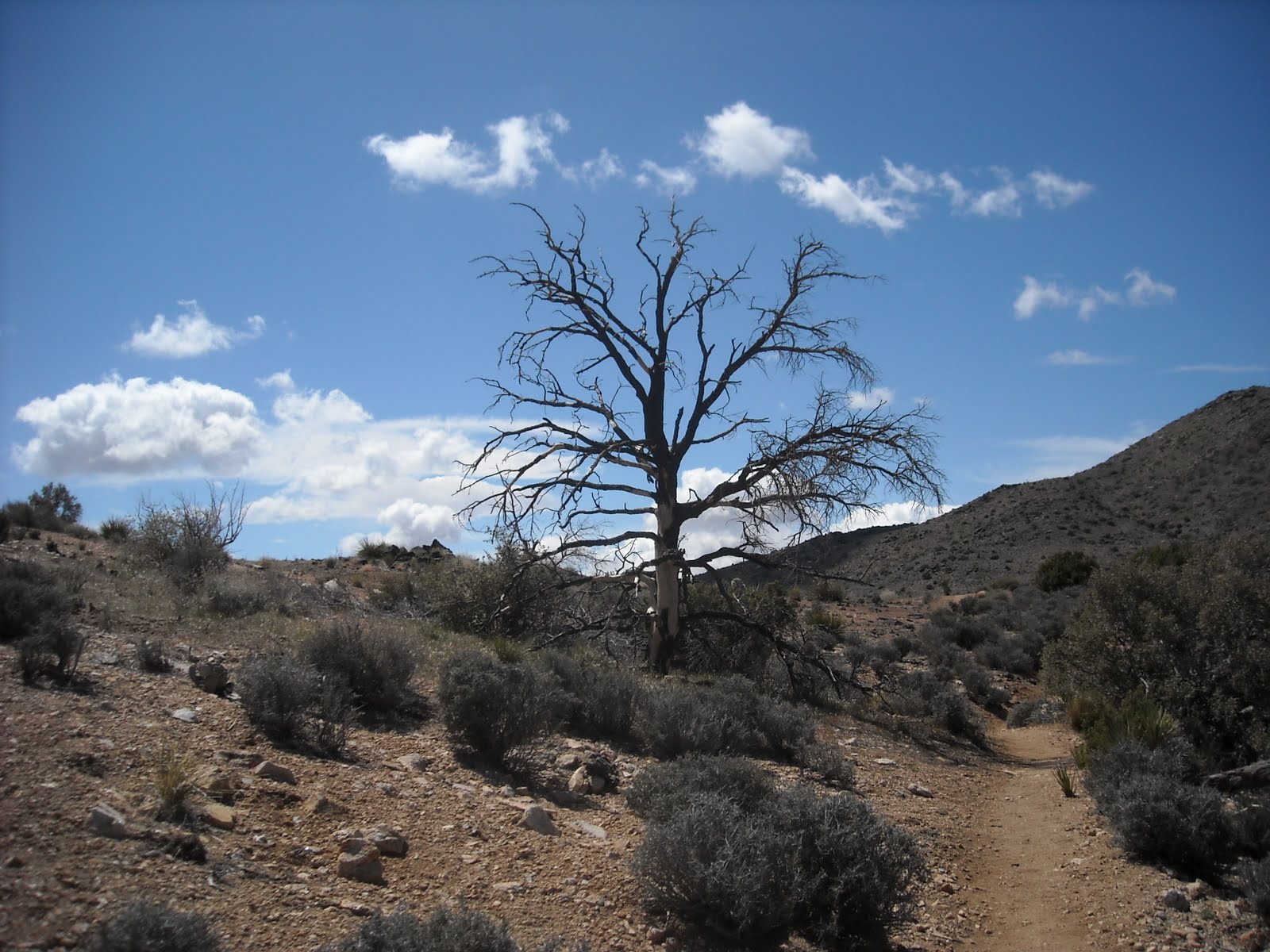
In this section, the trail gains elevation along the side of a broad, desert valley. As I went along through this section, the batteries on the palm sized camera died, so I was freed from taking pictures, and things sped up a bit. Eventually it crests in a flattish section at the head of the valley, and then tops out at the edge of a canyon. I followed the trail down into the canyon, switch-backing a few times. As I dropped ever lower, I was finally shielded from the wind, and at last, I was able to take of a few layers. Too, I looked up and there was clear, blue skies above. A bit of a trick, since before going down into the canyon, I had seen dark, black clouds on the horizon line. At mile marker 25, on the bottom of the canyon, I took a break, and enjoyed the first real sun of the day.
-
Of course, the ease of going into a canyon, is followed by the climb back out. The switch-backs make it a reasonable walk up. At the crest, I could see that the dark clouds had started to move in my direction, so I picked up the pace back to my car. The winds were getting stronger and the temperature was dropping. I remembered a few years earlier when what started out as a nice, winters walk, ended up in a snow storm. It may have been the desert, but I was slogging through ankle deep snow, by the time I got to the car. No snow on this trip, even though it felt cold enough for it. Just rain, a mile from my car.
-
At the Stubbe Springs Trail Loop sign, there is also a mileage sign listing the distance back to the trail head as 1.5 miles. I walked five miles beyond that, so that gives a total distance of 6.5 miles one way, 13 round trip. The sign board at Juniper Flats lists the trail's length as 35 miles. Pictures to follow in the next post.
-
I saw on the news that it was National Parks week, and that admission to all the parks was free. Well, I've been fighting bankruptcy for the past several years, and I was tired of watching every penny so, a little late in the morning, I admit, I drove from Los Angeles to the desert, and Joshua Tree national park.
-
After entering the park, I drove to the turn-off into Lost Horse Valley, and pulled into the Juniper Flats Trail Head parking area of the California Hiking and Riding Trail. With a week to go to May, a time of the year when it would normally be pretty warm in the desert, well, it wasn't. It was cloudy, the wind was blowing, and the temperature couldn't have been much over 50. Throw in the wind chill factor, which I can't explain, but I know it when I feel it, it was chilly. The shorts I was wearing weren't a problem, but I was lucky that I had decided to bring both a sweater and a jacket.
-
A short spur, a hard right out of the parking area, soon had me on the California Hiking and Riding Trail. I made a left, and headed west on the trail. It's an easy start. The trail, while sandy, has good footing and the general climb for the next few miles isn't steep enough to present any problems. Hiking in the Angeles National Forest and the Santa Monica Mountains, while beautiful, it's often difficult to escape the city. There are lots of places where the sounds of the L.A. urban area can be avoided, but it's also true that after miles of walking, it's possible to turn a corner on the trail and come across graffiti. And as someone who enjoys hiking at night, that night time glow is hard to avoid. Joshua Tree is a whole other experience. While physically close to L.A., Palm Springs, and San Bernardino, the size of the park, the lightly used trails, and the Joshua Trees themselves, is a reminder that the United States was once a vast wilderness, seen by few people.
-
One of the interesting features of the trial is the placement of mileage signs every mile. It's nice to know just how many miles walked, and it also makes it a bit easier to think ahead. Right past mile marker 20, (I picked up the trail a little past mid-point, and the first post I hit was mile marker 19.) there is a turn off to the Stubbe Springs Loop. I wouldn't trust that there will be water at Stubbe Springs. While I decided to stay on the trail, and not turn off, I have, in the past walked the loop, and never found the spring. With a detailed topo map, it might be easy to find water, but the trails in the Park are well maintained and simple to follow, so maps, beyond the one in the park brochure given out at the entrance gate, aren't all that necessary.
-
In this section, the trail gains elevation along the side of a broad, desert valley. As I went along through this section, the batteries on the palm sized camera died, so I was freed from taking pictures, and things sped up a bit. Eventually it crests in a flattish section at the head of the valley, and then tops out at the edge of a canyon. I followed the trail down into the canyon, switch-backing a few times. As I dropped ever lower, I was finally shielded from the wind, and at last, I was able to take of a few layers. Too, I looked up and there was clear, blue skies above. A bit of a trick, since before going down into the canyon, I had seen dark, black clouds on the horizon line. At mile marker 25, on the bottom of the canyon, I took a break, and enjoyed the first real sun of the day.
-
Of course, the ease of going into a canyon, is followed by the climb back out. The switch-backs make it a reasonable walk up. At the crest, I could see that the dark clouds had started to move in my direction, so I picked up the pace back to my car. The winds were getting stronger and the temperature was dropping. I remembered a few years earlier when what started out as a nice, winters walk, ended up in a snow storm. It may have been the desert, but I was slogging through ankle deep snow, by the time I got to the car. No snow on this trip, even though it felt cold enough for it. Just rain, a mile from my car.
-
At the Stubbe Springs Trail Loop sign, there is also a mileage sign listing the distance back to the trail head as 1.5 miles. I walked five miles beyond that, so that gives a total distance of 6.5 miles one way, 13 round trip. The sign board at Juniper Flats lists the trail's length as 35 miles. Pictures to follow in the next post.
Subscribe to:
Posts (Atom)